Gathering data in Royal Park to update masterplan
The City of Melbourne has collected, stored and analysed data captured by sensors in Carlton’s Argyle Square since 2020.
These insights, which show trends and patterns of use within the Square, help support the maintenance of the area and can inform future park usage and design.
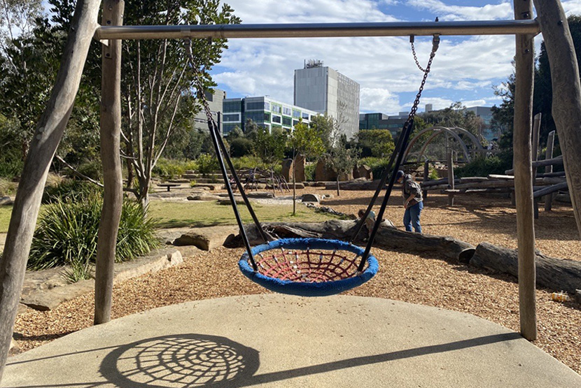
The Nature Playground in Royal Park is the latest outdoor area in the city for data collection, with sensors installed in August.
This award-winning playground is very popular with a high number of visitors and users and requires maintenance throughout the year to keep it in good condition.
Acting Lord Mayor Nicholas Reece said, “We know Melburnians love their parks, gardens and open spaces and that’s why we’re working hard to understand how we can make them even better.”
“Through important data collection, we can identify key trends such as peak park use time, pedestrian foot traffic, rubbish collection and even which park benches are the most popular.”
The last redesign of the park was in 1984. As a valued site for meeting, exercising, recreation and commuting, the council planners and designers will use the latest technology to understand how future redesign can further support users.
Installation of the first five sensors in the playground occurred in August 2022.
When someone uses a sensor-attached piece of equipment, the movement created from playing will be stored as data and kept as counts over time.
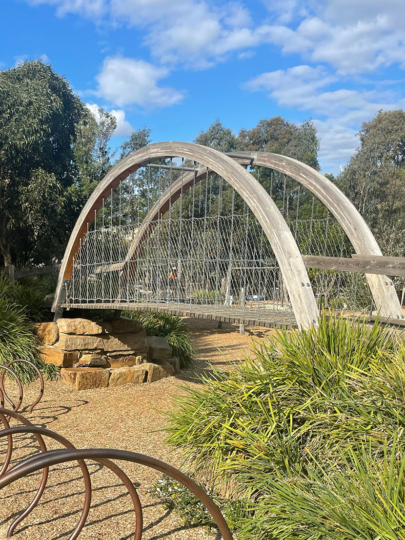
Another sensor that detects pedestrian and bike movement is due for installation on the pedestrian bridge in the park later this year. This data will help understand the flow of users.
These sensors will help identify the busiest times and days for popular play equipment, the typical usage of park equipment before maintenance is required, how much use the pedestrian bridge gets during peak play periods, and other key information.
As well as supporting park planners, designers and maintenance crews, the data can also empower the community to have more involvement in shaping shared community spaces.
The Friends of Royal Park expressed concern about this seemingly piecemeal approach to the Royal Park Masterplan review.
On enquiry to the City of Melbourne about the sensors and the consultation process, the Friends were advised that the council’s smart city team installed the sensors and the locations were in consultation with its open space planning.
Friends of Royal Park secretary Kay Oddie said, “This forms part of the background analysis work being undertaken over the next 12 months to inform the review of the masterplan.”
“The council is also undertaking intercept surveys in the park from September to December that will provide data from 200 random park users,” she said.
“[The council] intends to discuss the data and its implications with the Royal Park groups as part of the review process.”
Secretary of Protectors of Public Lands Victoria Inc. Michael Petit said, “like other community groups involved in the park we welcome a clarification from council on how these sensors will be used in the context of the ongoing multi-facetted review of the master plan.”
“[So far] the emphasis seems to be on people participation in the park.”
“It is equally important to remember that this is one of only three ‘dark parks’ in Melbourne because of the need to protect and maintain wildlife habitats.”
“The park has experienced many intrusions and it is essential that its original purpose as a dark park is maintained in this process.” •
Related Articles
Infrastructure plan puts focus on Carlton, Parkville and East Melbourne
The City of Melbourne’s new 10-year Community Infrastructure Plan has identified early years services, flexible community spaces, open space and partnerships with major institutions as key priorities for Carlton, Parkville and East Melbourne.
Read More
Council engagement to include ongoing listening posts
The City of Melbourne will introduce ongoing councillor listening posts and clearer consultation rules under a new community engagement policy aimed at making public feedback more meaningful.
Read More
Council moves to rein in AI infrastructure impacts as data centres surge
The City of Melbourne is aiming to guide the rapid expansion of artificial intelligence (AI) infrastructure, including data centres, as concerns grow about their long-term environmental and community impacts.
Read More
Da Guido La Pasta enters its next chapter
Infrastructure plan puts focus on Carlton, Parkville and East Melbourne
 Download the Latest Edition